Key Links

- Github: https://github.com/JGCRI/metis
- Webpage: https://jgcri.github.io/metis/
- Cheatsheet: https://github.com/JGCRI/metis/blob/master/metisCheatsheet.pdf
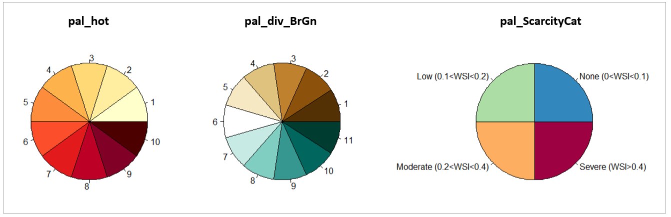
Color Palettes
- pal_metis
- pal_16
- al_seq
- pal_Basic
- pal_hot
- pal_green
- pal_wet
- pal_div_wet
- pal_div_RdBl
- pal_div_BlRd
- pal_div_GnBr
- pal_div_BrGn
- pal_div_BluRd
- pal_div_RdBlu
- pal_sankey
- pal_spectral
- pal_ScarcityCat
The following commands can be used to view the list of metis palettes as well as to visualize a particular palette and get a list of its colors:
library(metis)

names(metis.colors()) # View all palettes
metis.colors("pal_hot")
metis.colors("pal_div_BrGn")
metis.colors("pal_ScarcityCat")
Color Palettes
Maps
- mapCountries: World Map of Countries
- mapCountriesUS52: Merge of Countries and US52
- mapGCAMBasins: GCAM Basins
- mapGCAMBasinsUS49: Cropped of GCAM Basins and US49
- mapGCAMBasinsUS52: Cropped of GCAM Basins and US52
- mapGCAMLand: GCAM Land
- mapGCAMLandUS49: GCAM Land cropped to US49
- mapGCAMLandUS52: GCAM Land cropped to US52
- mapGCAMReg32: GCAM 32 Regions
- mapGCAMReg32US52: Merge of GCAM 32 and US52
- mapHydroShed1: HydroSHEDS level 1
- mapHydroShed2: HydroSHEDS level 2
- mapHydroShed3: HydroSHEDS level 3
- mapIntersectGCAMBasin32Reg: Intersection of GCAM Basins and GCAM 32 Regions.
- mapIntersectGCAMBasinCountry: Intersection of GCAM Basins and countries.
- mapStates: World Map of States
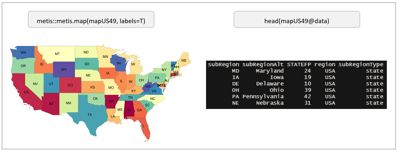
- mapUS49: US 49 States Excludes Alaska, Hawaii and Puerto Rico. Includes DC.
- mapUS49County: US 49 States Excludes Alaska, Hawaii and Puerto Rico. Includes DC.
- mapUS49HUC2: USGS Hydrological Unit Code (HUC)
- mapUS49HUC4: USGS Hydrological Unit Code (HUC)
- mapUS52: US 52 States Includes Alaska, Hawaii and Puerto Rico as well as DC.
- mapUS52County: US 52 Counties Includes Alaska, Hawaii and Puerto Rico as well as DC.
- mapUS52Compact: US 52 States with Alaska, Hawaii and Puerto Rico repositioned for compact US map.
- mapUS52CountyCompact: US 52 Counties with Alaska, Hawaii and Puerto Rico repositioned for compact US County map.
- mapUS52HUC2: USGS Hydrological Unit Code (HUC)
- mapUS52HUC4: USGS Hydrological Unit Code (HUC)
The following commands can be used to view a particular map and the data contained in the shape file:
Example View of Pre-loaded Map for US49
Params
The following command will provide an updated list of params and paramSets to be used in metis.readgcam.
library(metis); library(dplyr)

metis.mappings()$mapParamQuery%>%dplyr::select(-query,-mapPalette)
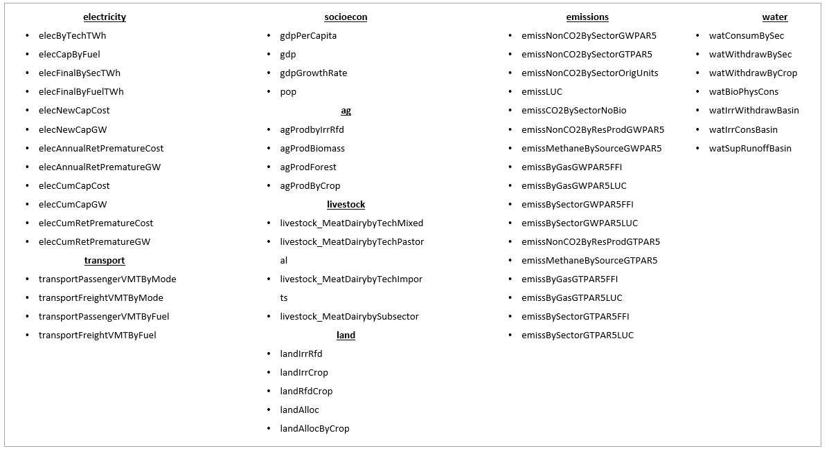
List of key Params for readGCAM